Observed interannual variability of the Kuroshio and Luzon Undercurrent associated with tropical and subtropical wind forcing
Jie Ma, Zhanqing Zhang, Shijian Hu*, Cesar Villanoy, Xinying Guo, Fan Wang, Dunxin Hu
Published in Progress in Oceanography, December 2023
The interannual variability of the Kuroshio and Luzon Undercurrent (LUC) east of the Luzon Island is examined using observations from a moorings during December 2010–October 2012 and three moorings during January 2018–May 2020 deployed at 18°N. Measurements from acoustic Doppler current profiler (ADCP) equipped on the moorings indicate that the interannual variations of upper-layer Kuroshio and lower-layer LUC were in phase. The interannual variability is strong in the Kuroshio but weakens substantially in the LUC. A proxy of the Kuroshio and LUC based on sea level slope is developed and validated by comparing the ADCP and satellite altimeter measurements. The proxy during 1993–2020 shows that the interannual sea level slope across the Kuroshio is primarily associated with sea level fluctuations on its eastern flank. Diagnostic analysis and numerical sensitivity experiments using a simplified ocean model indicate that the wind forcing in the subtropical northwestern Pacific Ocean played an essential role in the interannual variability of Kuroshio and LUC’s strength and water mass properties during the observation periods in 2011 and 2018–2020, although the tropical winds dominated the interannual variability of the two boundary currents during most time of the past three decades (1993–2020). The mooring observations show that the subsurface water mass in the LUC at the depth of about 650–800 m experienced a considerable freshening event from July 2019 until at least January 2020 due to abnormally strong subtropical wind forcing.
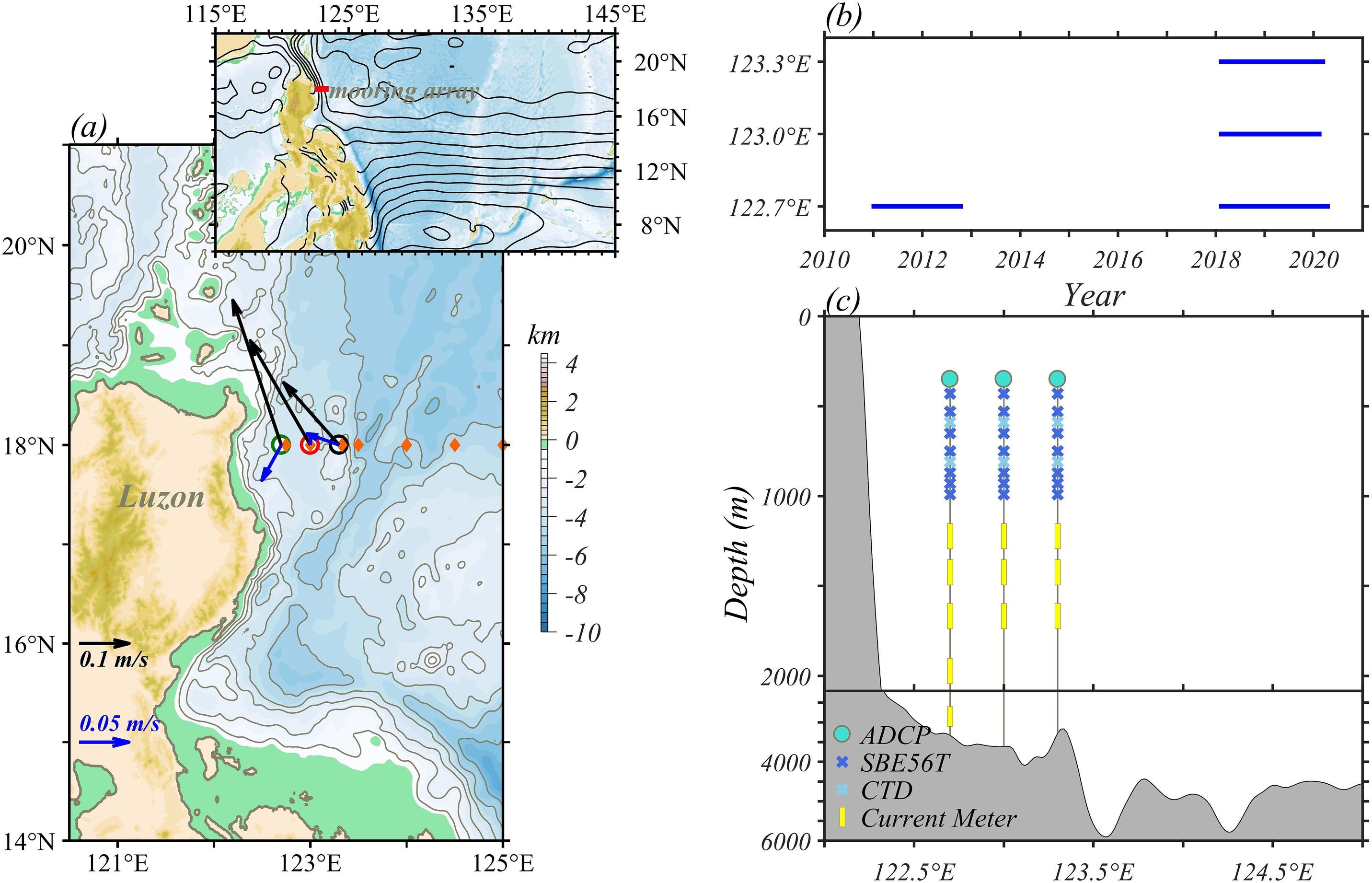
Fig. (a) Bathymetry of the western Pacific Ocean from the ETOPO1 database, with contours lines every 1000 m (gray lines). Black (blue) arrows denote the mean velocity in the upper 500-m (500–1000-m) layer at the mooring locations (circles) and orange diamonds indicate CTD/LADCP hydrographic stations along the 18°N transect. The inset map shows a larger domain with the mooring array shown by the red horizontal line, and the black contours denote the absolute dynamic topography averaged for January 2018–May 2020. (b) Time span of the mooring observations along the 18°N transect used in this study. (c) Vertical cross-section of the mooring array. The instrument types are as indicated in the legend. The bathymetry of the continental slope is shown in gray shaded.
Ma, J., Zhang, Z., Hu, S., Villanoy, C., et al. 2023. Observed interannual variability of the Kuroshio and Luzon Undercurrent associated with tropical and subtropical wind forcing. Progress in Oceanography, 219, https://doi.org/10.1016/j.pocean.2023.103146